Friday, February 19, 2010

19/02/2010 Siggiewi - Ghar Lapsi - Laferla Cross - Rabat


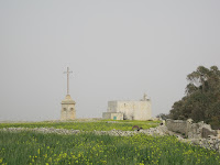
On a warm but slightly hazy day we set off from Siggiewi for Ghar Lapsi where we stayed a while to admire the attractive bay and some crashing waves. After stopping for refreshments we retraced our steps climbing towards Dar tal-Providenza, turning left towards the Annunciation Chapel. We rested a while at Ta Zuta Chapel before climbing the rocky path towards Dingli Cliffs, the highest point on the island. We turned right to take the road between two busy quarrries. Immediately after the quarry on our right we took the right hand path to take the long steady climb towards the Laferla Cross which we reached via a narrow path to the left of a small chapel. We then continued sharply downhill past a series of statues, turning left onto the road and then taking the left fork immediately afterwards. We turned right at the GR stone to follow a path between farmhouses that became quite narrow at tmes. We crossed the Wied via a small stone bridge, carried straight on across the road and climbed towards the Verdala Palace. Following the road to the right of the Palace, we then turned right along the road to Rabat where we caught our bus back. Distance: c. 12 miles, very rough in places with several stiff climbs but with the reward of some of the most spectacular coastal and countryside views in Malta.

17/02/2010 Mgarr


We set off from Mgarr church in the direction of Gnejna Bay. After a short detour we returned to the road and, on reaching a crossroads, we turned right towards the cliffs rather than take the steep downhill to the bay. After a few hundred yards we turned left onto a path that took us to Lippija Tower. After a few minutes of photo opportunities and admiring the views across the various bays we retraced our steps along the path. We then turned left to continue on our way passing the Roman Baths on our left (closed for refurbishment for the last couple of decades or so). We then turned right and, after a mile or so, right again to bring us back to Mgarr church with its unusual egg-shaped dome. Distance: about 5 miles of easy walking apart from a short slightly rocky downhill section towards the Roman Baths.

Saturday, January 30, 2010

29/01/2010 Victoria Lines


We set off once again from Targa Gap, outskirts of Mosta, this time in the direction of Mosta Fort, joining the Victoria Lines after a few hundred yards. Just before we reached the Fort we turned right through the gardens to join the ring road where we turned left. We then had to follow the main road for a while with the Victoria Lines to our left. We crossed the Wied Ghassel, still following the main road which then skirted a huge quarry. Eventually, we crossed the Naxxar Road and contined on until we once again joined the Victoria Lines. We skirted another quarry, this time on our right, and crossed another valley. We then continued on through a park, outskirts of Gharghur. Just before a viewing platform we turned left down some rough steps to follow the Victoria Lines again as they dropped into a deep valley. The path was extremely rough at this point. We came up beside some villas and, upon reaching a small road, turned right. We descended towards the coast, turned left and crossed the coast road before turning right towards White Rocks, a long abandoned holiday village, where we were forced to shelter from a very heavy shower. We turned left down towards the coastal path and turned left again behind the Splash Park at Bahar Ic-Cahag. Rejoining the coast road we followed it for some distance in the direction of Qawra but turned off at Ghallis Tower. We followed a path through the farms, turning right into the Naxxar Road and then left, following a narrow road which eventually turned to the right past a fireworks factory. We took a right fork and descended past a small chapel and followed the path round until it eventually led to Kennedy Grove. We finished our walk at Salini Park.
Distance: 12 miles, mainly steady walking but with some very rough terrain in places.

Thursday, January 28, 2010

27/01/2010 Buskett Gardens - Dingli Cliffs


We started our walk from the Rabat end of Buskett Gardens. After exploring the gardens for a while - and finding one exit blocked by several large dogs - we left the gardens at the exit nearest Dingli Cliffs and followed the signs for the cliffs. We turned right on reaching the coast and walked on past the Maddalena Chapel and the Radar Dome as far as Bobbyland where we stopped for refreshments. We retraced our steps but then turned left towards Dingli Village. We turned right out of the village and then right again just after the college to arrive back at Buskett.
Distance: 5-6 miles, mainly easy walking except for a few uphills.

Sunday, January 24, 2010

24/01/2010 Salina Bay


We set off from Qawra through the new Salini Park, with its picnic areas and water features, following the path down to the Kennedy memorial. We walked through the memorial past the new fountains turning right to the main coast road. We turned left keeping the small, recently refurbished "canal" on our left and, beyond it, the Salina Bay salt pans. We crossed the coast road at the tiny village of Salini and, after following the Naxxar Road for a few yards, turned left past a restaurant and the small village chapel. To the right of the chapel we followed a narrow path round a field that led to the Salini catacombs. After exploring these ancient catacombs we returned the same way we came.
Distance: 2 miles, gentle stroll.

22/01/2010 Victoria Lines - Bingemma - Mtarfa


We set off from Targa Gap, on the outskirts of Mosta, following the Victoria Lines, a line of fortifications that crosses the whole of the island. At the Mosta-Mgarr Road we turned left then almost immediately right up a steep narrow path. Stopping several times to admire the spectacular views across to St Paul's Bay and Gozo in the distance, we climbed to one of the highest points on the whole island. At a t-junction we were careful to take the left hand path that runs behind the Dwejra Lines section of the Victoria Lines. After a while, we were able to leave the path to the right to follow a narrow path along the Lines themselves - more spectacular views but not for the faint-hearted. We eventually rejoined the main path and descended to the Bingemma Gap where the lines cross a valley with catacombs dug into the cliff face.
Climbing to the road, we turned left and, after a few hundred yards, right towards the Bingemma Fort. We continued to follow the narrow road to a small hamlet at a t-junction where we turned left. We followed the road which ran steeply downhill to a small bridge. We left the road via a narrow path to a picnic area tucked underneathe the bridge. We took a narrow muddy path alongside a small stream which eventually brought us out at another narrow bridge where we crossed to the other side of the stream where we turned immediate right towards Chadwick Lakes.
We then turned right up the steep hill towards Mtarfa, a former military area, now a large housing estate with some impressive buidings. We turned left to follow the Belvedere with its views across the valley, heading towards the clock tower. We descended in the direction of Mdina, straight on at the road island before turning right and climbing a steep minor road that led into Mdina via the gap in the Citadel wall that once led to the railway station. We finished our walk with a stroll through the ancient streets of Mdina to the bus station.

Distance: 10 miles, tough walking in places.

20/01/2010 Chadwick Lakes


The Chadwick Lakes, constructed in the 19th century via a series of dams, are well worth a visit but best in late winter, particularly after heavy rain. Starting from the small chapel of San Pawl just outside Mosta, where our group stopped to admire the sight of a goat with four small chicks, we crossed the Mdina Road before turning right towards Chadwick Lakes. We continued along the path before it became too muddy before returning back the way we came.
Distance: 4 miles, gentle walking.